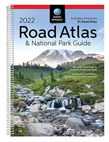
Pinpoint the best in the best: America’s national parks. With essential information and tips, hundreds of photos and maps, and a complete road atlas, this guide is all you need to have extraordinary park experiences. A four-color, 132-page National Park Guide details the best of the best in each park—from trails, drives, and natural wonders to programs, museums, and lodges. Hundreds of photos capture the essence of each park. Park inset maps highlight key points-of-interest. Other Features: Updated maps of every U.S. state and Canadian province and an overview map of Mexico. Inset maps of over 350 cities and 63 U.S. national parks. Road construction and conditions contact information for every state conveniently located above the maps. Mileage chart showing distances between 90 North American cities and national parks along with a driving times map.Tourism websites and phone numbers for every U.S. state and Canadian province on map pages. Spiral Binding. Dimensions 10.875 x 15.3125
Sale end in:
Rand McNally 2022 Road Atlas & National Park Guide (Rand McNally National Park Road Atlas and Travel Guide)
By: Rand McNally
ISBN-10: 052802373X
ISBN-13 : 978-0528023736
Publisher : Rand McNally (April 19, 2021)
Language : English
Paperback: 272 pages
Reading Age : None
Dimensions : 11.5 x 0.75 x 15.37 inches
Item Weight : 2.5 pounds
$24.31 $19.45
SKU9780528023736
Customers reviews
Be the first to review “Rand McNally 2022 Road Atlas & National Park Guide (Rand McNally National Park Road Atlas and Travel Guide)” Cancel reply









There are no reviews yet.